


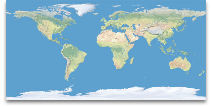
World physical map at 1.24 km resolution

Introducing Natural Earth
I created Natural Earth as a mapping resource for the US National Park Service (NPS). The 391 parks in the NPS System span a wide expanse of Earth’s surface—11 time zones in all—from the Caribbean to arctic Alaska to the South Pacific. The aim of Natural Earth is to show the parks not as isolated places but in an interconnected context on a world map with major environmental zones.
Made primarily from data and imagery collected by NASA satellites and graphically enhanced by the NPS, Natural Earth is a base for general mapmaking. The combination of shaded relief and landcover colors brings the physical world to life and encourages readers to explore. You are invited to visit the gallery, download and print the poster image, and download the high-resolution data for making maps of your own.
Tom Patterson
US National Park Service
Return to Shadedrelief.com