


Natural Earth Gallery
Click numbers on map for detailed enlargements
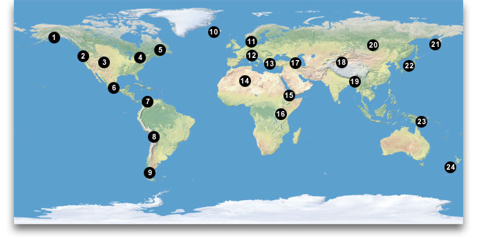
2. Northwest US
3. Central Rockies
4. Northeast US
5. St. Lawrence R.
6. Mexico
18. Bolivian Andes
19. Patagonia
10. Iceland
11. Scandinavia
12. Alps
14. Ahaggar Mts.
15. Danakil
16. Lake Victoria
17. Caucasus Mts.
18. Taklimakan
20. Lake Baikal
21. Kamchatka
22. Japan
23. New Guinea
24. New Zealand
Maps in the gallery appear at full 1.24 km resolution, except for the Central Rockies, Northeast US, Patagonia, Alps, Caucasus Mts, and Taklimakan, which are smaller in scale. All maps use the plate carrée projection, which horizontally elongates high-latitude areas, such as Alaska, Iceland, and Patagonia.
Also see the Natural Earth poster in the download section.
Return to Shadedrelief.com