 |
 |
 |
 |
 |
 |
||||||||||
|
Natural Earth III – Extra Data
|
|||||||||||||||
|
|
|||||||||||||||
|
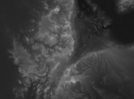
Full coverage |
Detail (Ethiopia) |
||||||||||||||
 |
 |
||||||||||||||
|
Download:... |
Large grayscale DEM – 16-bit TIF, 10,800 X 5,400 (26.6 MB) |
||||||||||||||
|
|
|||||||||||||||
|
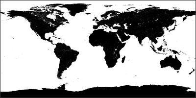
2. Land/water mask
|
|||||||||||||||
|
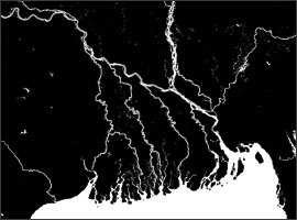
Full coverage |
Detail (Ganges delta) |
||||||||||||||
 |
 |
||||||||||||||
|
Download:...16,200 x 8,100 PNG (4.8 MB)......8,192 x 4,096 PNG (2 MB) |
|||||||||||||||
|
|
|||||||||||||||
|
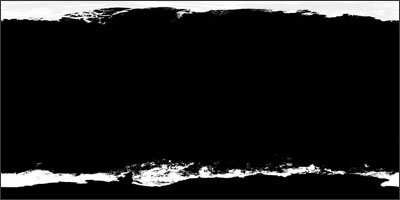
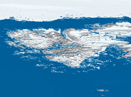
3. Arctic and Antarctic sea ice mask
|
|||||||||||||||
|
Full coverage |
Sea ice mask applied to Svalbard, Norway |
||||||||||||||
 |
 |
||||||||||||||
|
Download:...16,200 x 8,100 PNG (11.1 MB)......8,192 x 4,096 PNG (2.2 MB) |
|||||||||||||||
|
|
|||||||||||||||
|
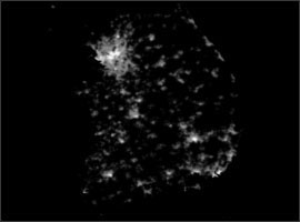
4. Urban land cover mask
|
|||||||||||||||
|
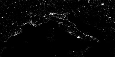
Detail (N. Mediterranean coast) |
Detail (S. Korea) |
||||||||||||||
|
 |
||||||||||||||
|
Download:...16,200 x 8,100 PNG (1.3 MB)......8,192 x 4,096 PNG (532 KB) |
|||||||||||||||
|
|
|||||||||||||||
|
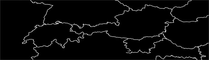
5. International boundary mask
|
|||||||||||||||
|
Detail (Central Europe) |
|||||||||||||||
 |
|||||||||||||||
|
Download:...16,200 x 8,100 PNG (940 KB)......8,192 x 4,096 PNG (348 KB) |
|||||||||||||||
|
|
|||||||||||||||
|
5. Starfield backdrop (fictional depiction of outerspace)
|
|||||||||||||||
|
Detail |
|||||||||||||||
 |
|||||||||||||||
|
Download:...6,000 x 4,500 JPEG (5.6 MB). |
|||||||||||||||
|
|
|||||||||||||||
|
About the data
Terrestrial elevation data – downsampled SRTM30 Plus with filled oceans. The large 10,800 x 5,400 grayscale DEM is very detailed. For creating more legible terrain on Natural Earth III texture maps, use the smaller 8,640 x 4,320 DEM. The large 16,200 x 8,100 bump map derives from the 8,640 x 4,320 DEM. Land/water mask – from Natural Earth II. Water bodies derive from downsampled MODIS VCF satellite data combined with rasterized rivers from World Data Bank 2. Arctic and Antarctic sea ice – originally from NASA Blue Marble, obtained at The Celestia Motherlode, a great site with highly realistic Earth textures. Antarctic sea ice looks most natural when given the same color as Antarctic ice shelves. The contact between sea ice and ice shelves will require touchups to prevent a faint line of blue water pixels from showing through. Urban land cover – a combination of AVHRR extracted from Global Land Cover Characteristics Data Base Version 2.0 and Binary MOD12Q1 data (a MODIS-based product) obtained from Boston University, Department of Geography. Note: urban land cover is not the same data as that used for the Earth at night (texture 5). The land cover gives a sparser portrayal of world urbanization. International boundaries – a rasterized ESRI Shapefile provided by the Office of the Geographer, US Department of State. Boundary representation is not necessarily authoritative. Starfield backdrop – based on an image by Roger Klump. A tutorial that accompanies the image explains his innovative technique for creating fictional stars. |
|||||||||||||||
|
|
|||||||||||||||
| Projection and georeferencing Download:...Projection information and world (.tfw) files (4 KB) |
|||||||||||||||
|
|
|
|
|
|
||||||||||