 |
NACIS Map Design Survey – Results........
Questionnaire
Map examples
Comments
PART 2 – MAP EXAMPLES
Name a map made by either yourself or someone else that is an example of good map design.
1. The topographic maps of Switzerland 1:25000, by Swisstopo.
2. North Carolina Coastal Land Trust Service Area
3. Any of the 1:50,000 topographic map series by the Institut Cartographica de Catalunya especially the Barcelona sheet (or their 1:25,000 map of their National Park), or the Belgian military 1:50,000 topo map series M737 especially the Antwerpen sheet.
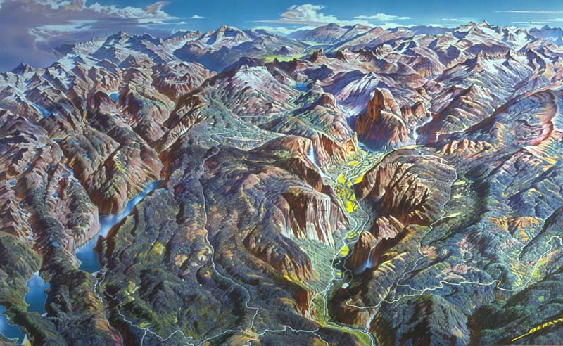
4. Yosemite panorama by Heinrich Berann
5. 14th Edition of the Maine Appalachian Trail Maps
6. Map of Burma by Geografiek
7. Cappelens kart no. 13: "Hele Norge" 1:1 mill. road map of Norway. Oslo, 2007.
8. California annual precipitation map
9. "Annapolis Grand Tour." Lucidity Information Design, LLC, Robert Cronan, designer/artist. 2006. Historic Annapolis Foundation.
10. Raven North America
11. NPS Glacier Bay, Alaska, map
12. Interactive map of University of Wisconsin-Madison
13. www.reliefshading.com/examples/matterhorn.html
14. I think a superb example of a well-designed map that integrates incredible detail is the Stadtplan Berlin published by the Berlin transport agency, BVG. It includes excellent street-level detail AND both bus and train info, with a nice hierarchy of foreground and background info. In addition, the design uses harmonious colors and typefaces, which are integrated with the BVG system signage, website, other publications, etc. Berlin Stadtplan, published by BVG (Berliner Verkehrsbetriebe)carries the ISBN 3-9807716-3-6. There's also a smaller version that covers only the central city. Here's a scan of a small portion: There's also an online version. The cartography was done by Pietruska Verlag and GEO-Datenbanken, Berlin.
15. Title Milwaukee (Wisconsin) 1927, Caspar’s official map of the City of Milwaukee and vicinity / compiled for C.N. Caspar Co., Publishers... by R.A. Campbell, C.E. Creator Campbell, R. A. (Robert Allen) Contributors C.N. Caspar Co. Publication Date c1927.
16. U.S. National Atlas, General Reference - Wall Maps. It's not the greatest in cartography, but it is one of the few that correctly maps all 50 states and is a true "United States" map. If you look at any of the federal websites, you would be hard pressed to find a "United States" map that doesn't severely under represent Alaska, Hawaii, etc. The Forest Cover and Wilderness maps are similarly good examples. Any map representing North America as a whole also wins points. Cartographicly, I would suggest maps produced byJeff Bennett of the National Park Service, Alaska Regional Office be worth a nomination. I am uncertain, however, if these have been distributed publicly. In particular, he did a nice job with the Katmai National Park and Preserve Water Resources maps and with producing imagery maps with annotation for all of the Alaska parks.
17. Physical Features Map, National Atlas of the United States 2006 USGS Stock # 206944 Contact: Jay Donnelly, jdonnelly@usgs.gov.
18. http://lmvmapping.erdc.usace.army.mil/index.htm
|
|
Also in this section:
 University Cartography Labs University Cartography Labs
List of Custom Cartography Companies
Join NACIS!
Other Map Sites:
CartoTalk
The Map Room
Mapping Hacks
CCA Blog
Urban Cartography
Cartographic Users Advisory Council (CUAC)
ShadedRelief.com

Find Cartography Jobs on Monster.com
|
|