Explore the US coast to coast
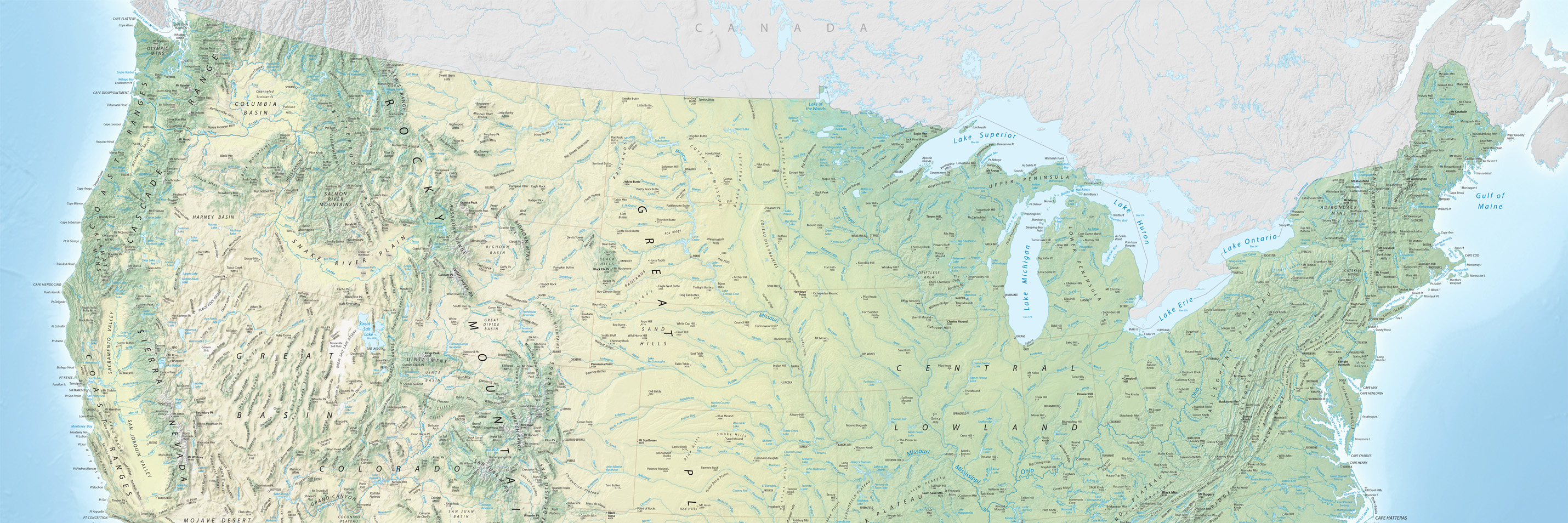
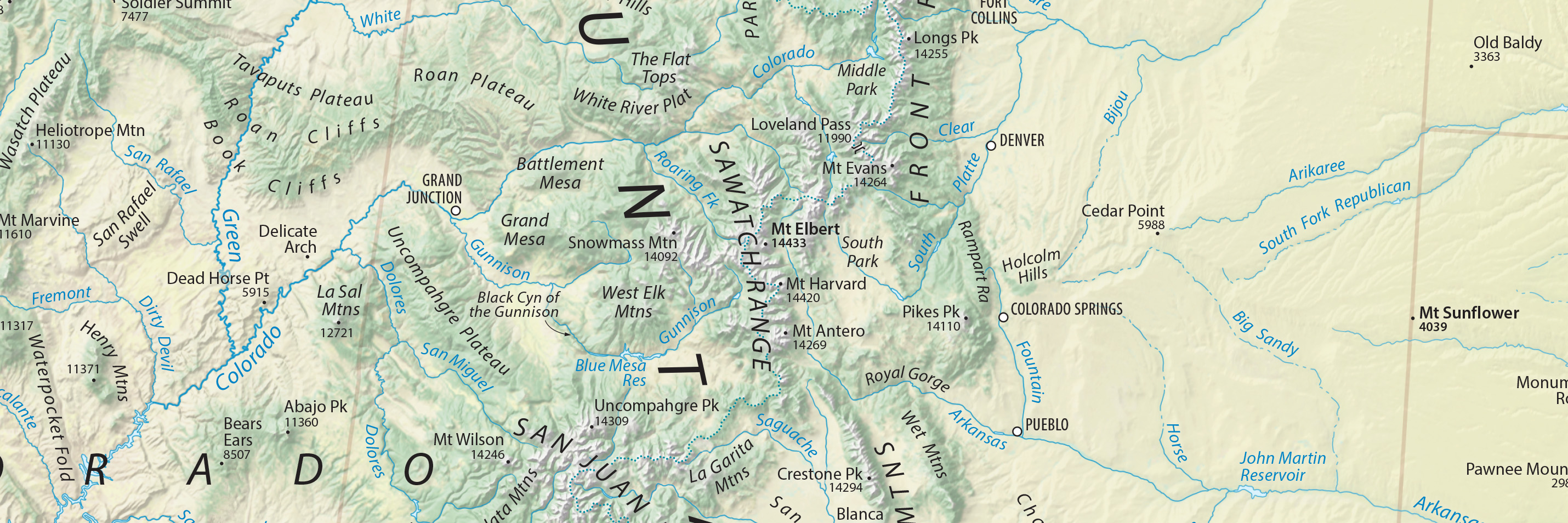
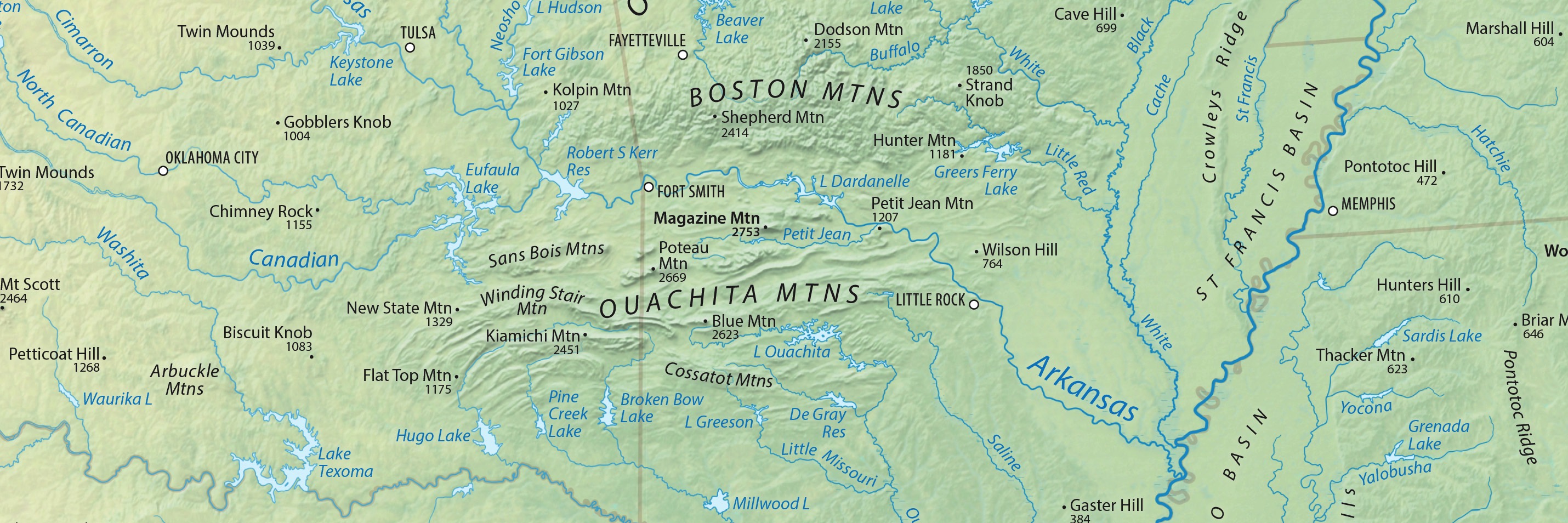
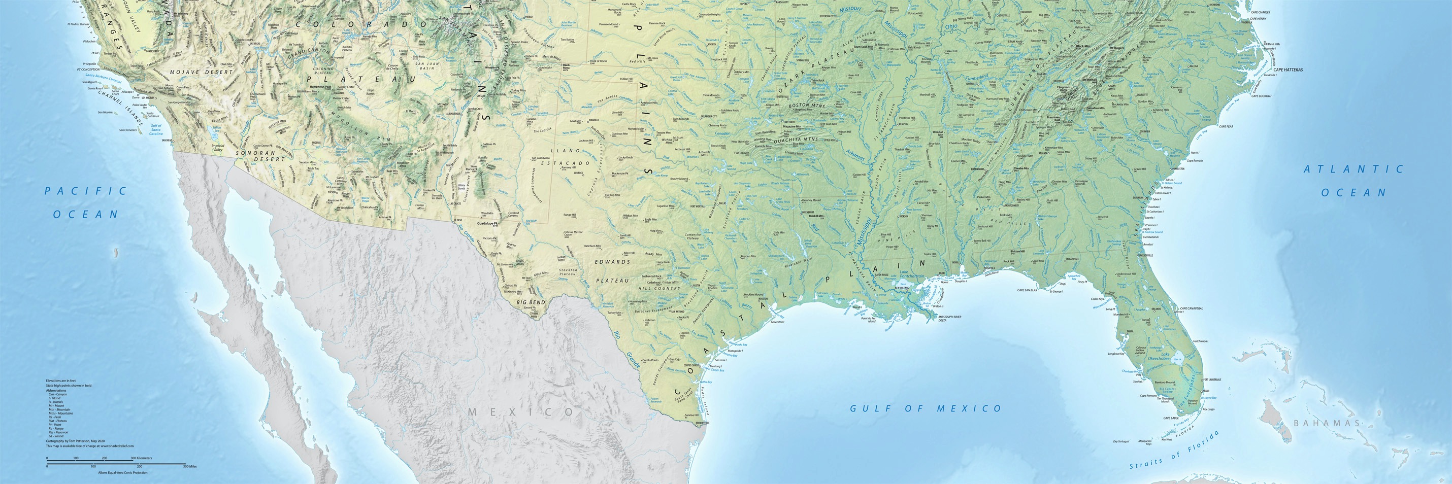
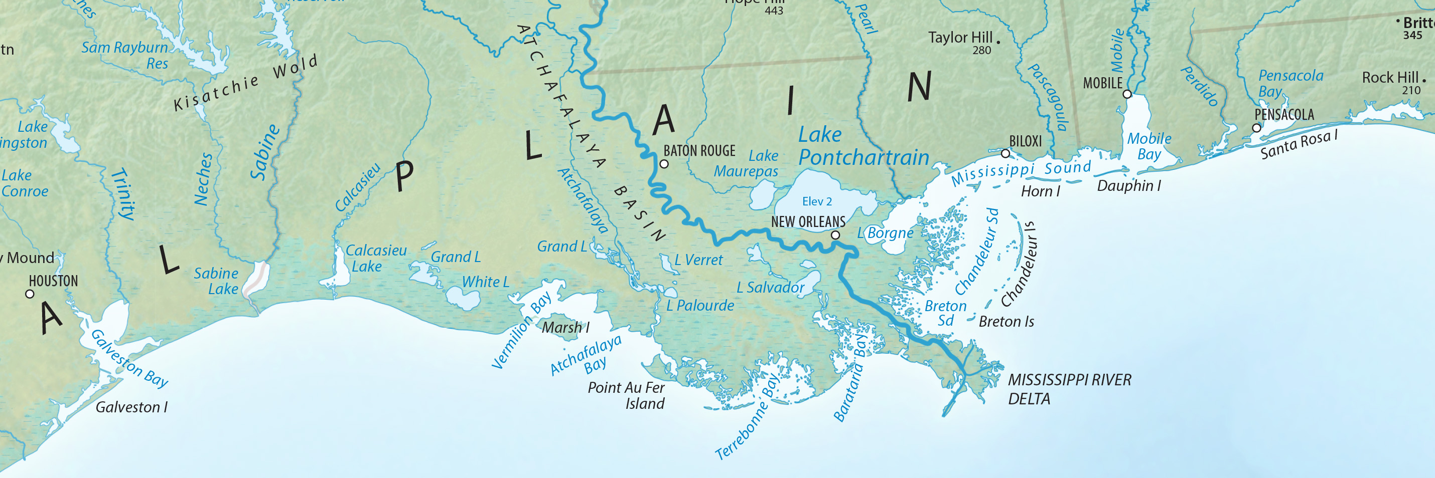
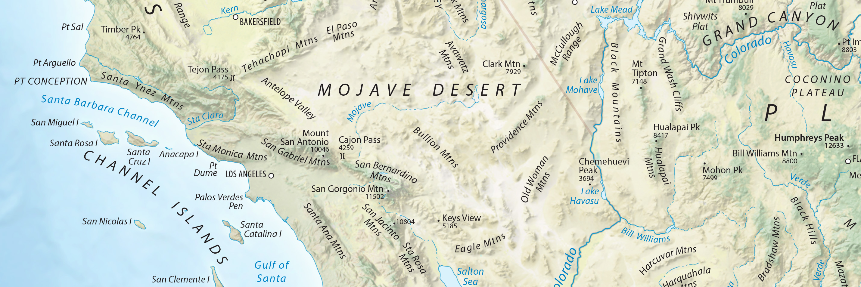
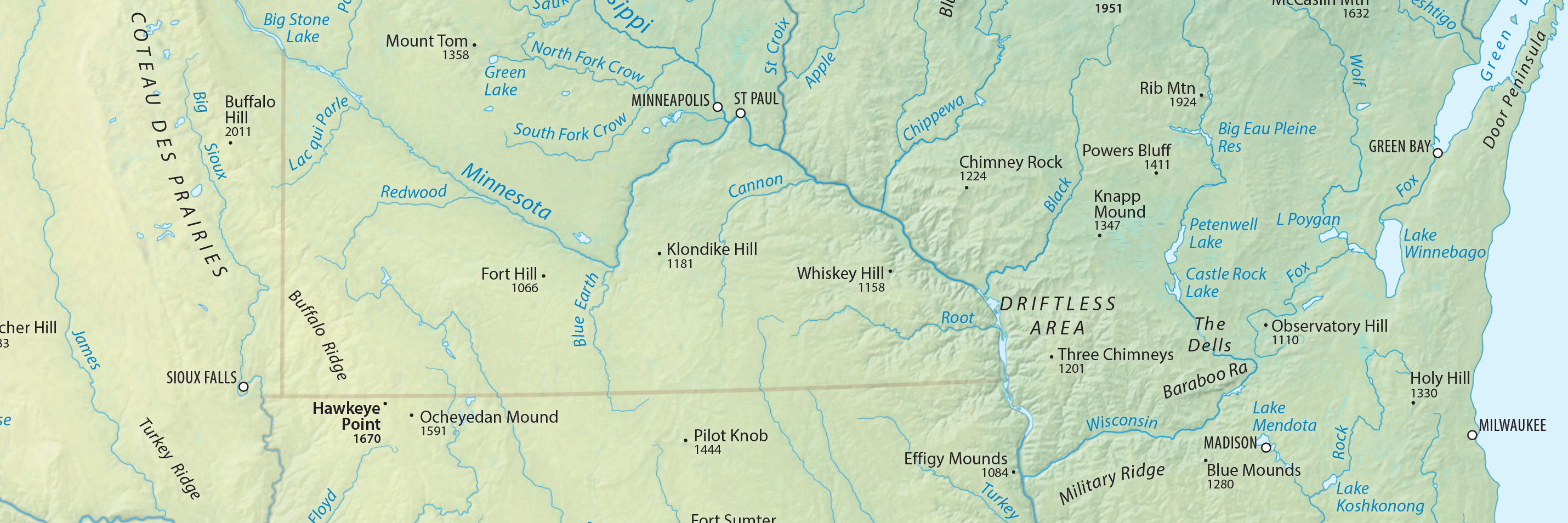
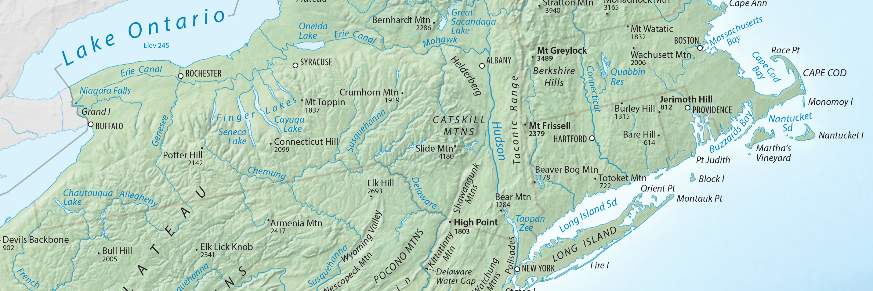
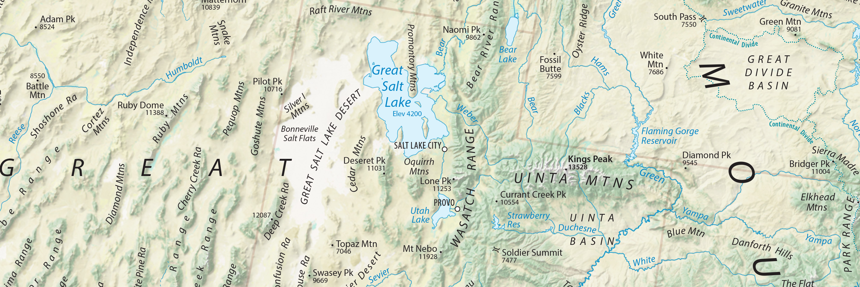
This map showcases physical features—mountains, plains, rivers, lakes, etc.—of the 48 contiguous US states. Map colors reflect natural environments across the continent from the forested east to the snowcapped Rockies to the desert southwest. You will also find a smattering of cities and faint state lines for reference.
With abundant physical features everywhere, a challenge was selecting what to show on the map. I scoured atlases, US Geological Survey topographic maps, and online sources to identify intriguing features. A draft of the map posted on Twitter had 35,000 views in 24 hours. Many of you wrote back with excellent suggestions and to inform me of errors. I am very grateful for your help.
The map is in the public domain and available free of charge. I hope that you find it enjoyable and informative.
Tom Patterson
May 11, 2020
Map downloads—pick the version best for you
Physical Map of the Contiguous US
On-screen viewing and high-resolution printing
Terms of use
The Physical Features of the Contiguous US map is in the public domain. You may use it any way that you want. You are not required to cite the map.
3,000+ labels!
Modifying and repurposing the map
Terrain art without type halos
Georeferenced terrain, no rivers and lakes, GeoTIFF, 121 MB
Georeferenced terrain, with rivers and lakes, GeoTIFF, 122 MB
Contact me
I will periodically update the map. Please let me know about major features to include or any problems that you find.
Thanks!
Tom Patterson Bio
P.S. Also check out the Seafloor Map of Hawaii here.
Version 1.01, May 17, 2020