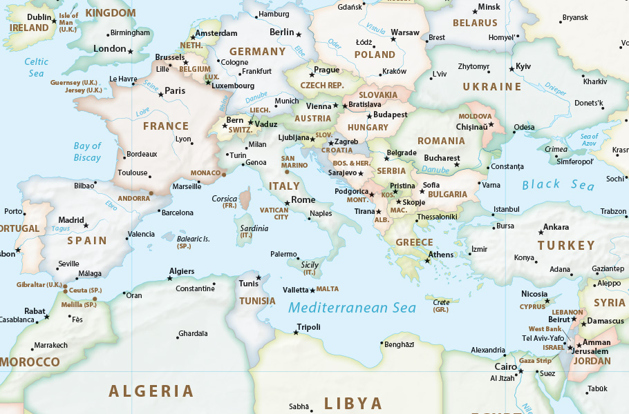
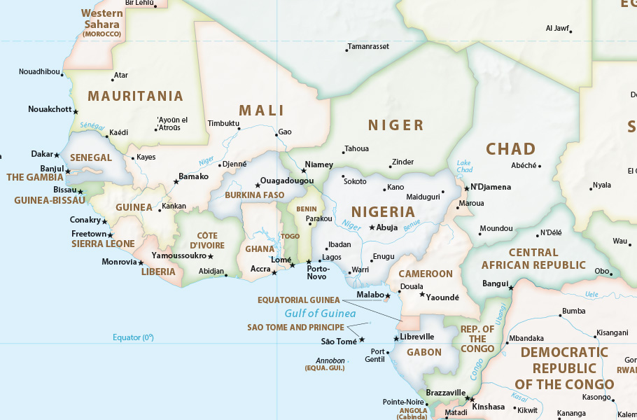
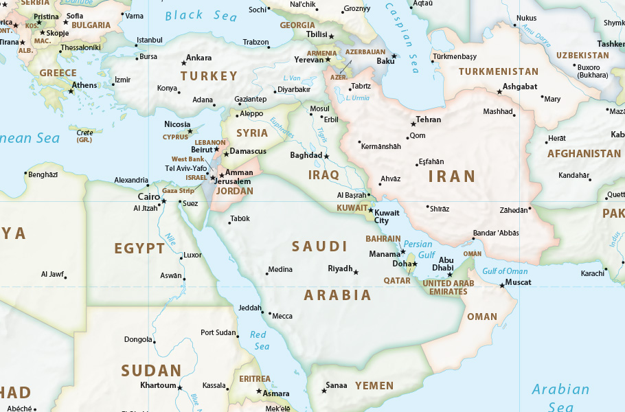
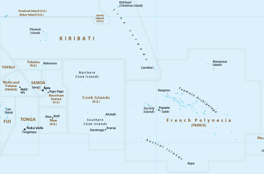
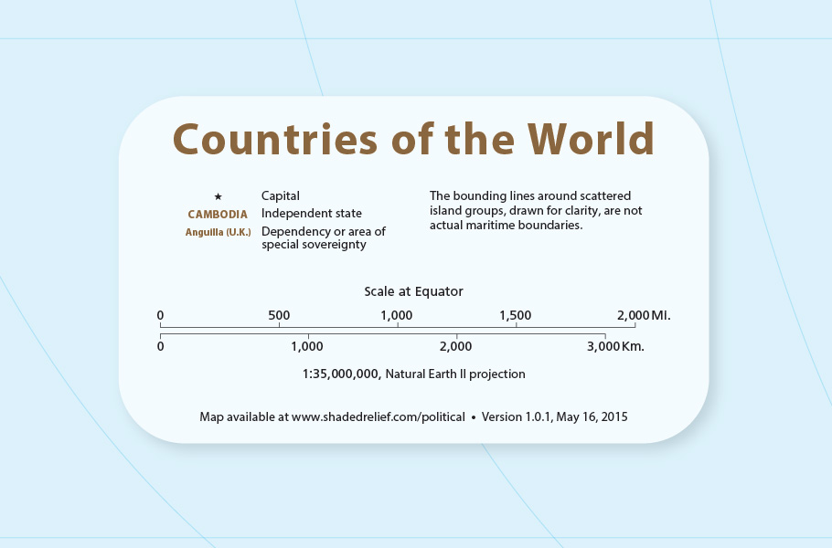
World Political Map |
|||||||||||||||
Free, editable, and in the public domain |
|||||||||||||||
 |
|||||||||||||||
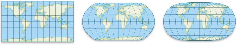
Download the map The map is available below as a JPEG image or PDF for quick reference and printing, or as a layered Adobe Illustrator CC file that you can customize. Choose from three map projections ranging from a rectangular shape (Patterson) to a slightly rounded shape (Natural Earth) to one that is highly rounded (Natural Earth 2). |
|||||||||||||||
Patterson |
Natural Earth |
Natural Earth 2 |
|||||||||||||
 |
|||||||||||||||
Includes MAPublisher georeferencing |
|||||||||||||||
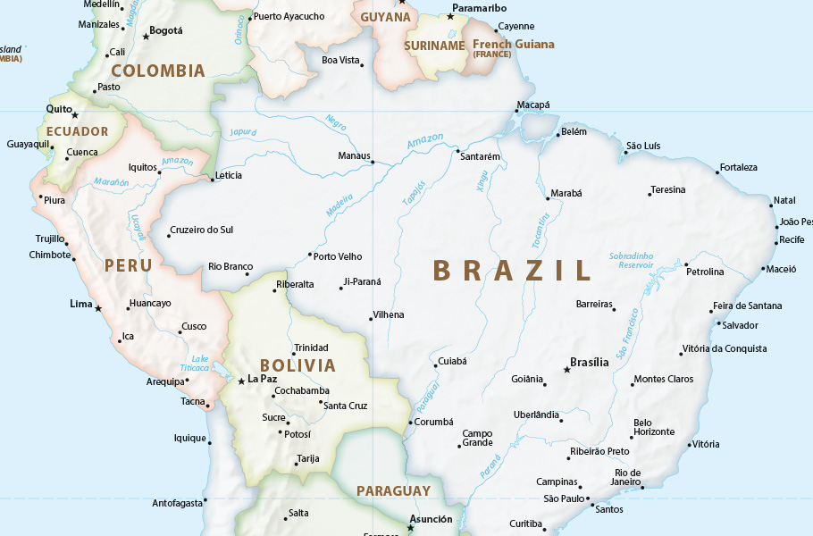
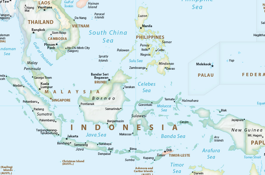
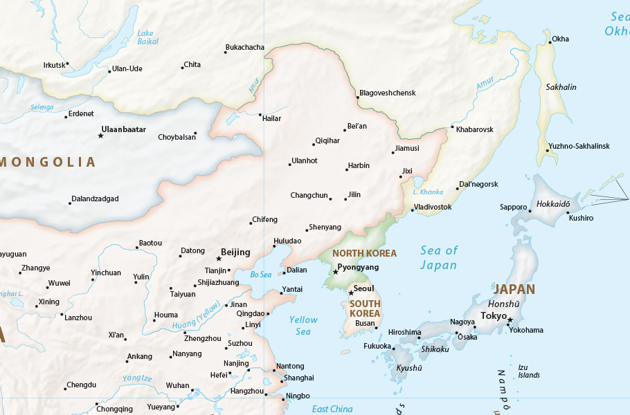
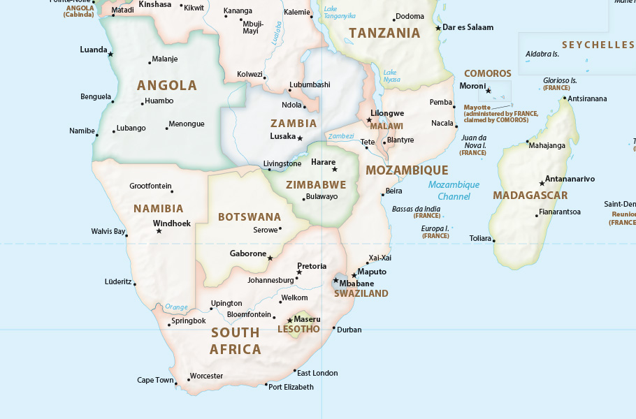
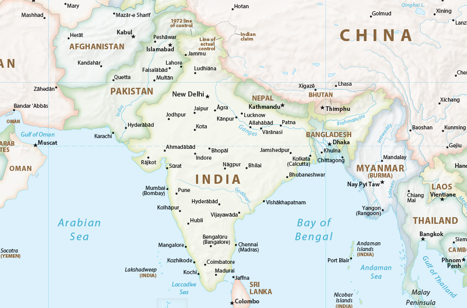
Terms of use These maps are in the public domain. You may use them any way you like, including modifying the content, selling them for profit, and claiming them as your own. If you modify the maps in any way, please do not identify me as the author—they are now yours. If you use the maps in their original form, crediting me as the author is unnecessary. Should you absolutely need to cite the maps, and provided that they are unmodified, the following will suffice: Map by Tom Patterson, ShadedRelief.com Publishers and authors: please do not contact me asking for permission to republish the maps—you already have it right here. By downloading and using these maps you agree that the map author (Tom Patterson) is not legally responsible for any errors that the maps may contain. You are solely responsible for all problems that may arise from reuse of the maps and their redistribution to third parties. Tom Patterson does not endorse the individuals or organizations that may use the maps, nor does he endorse their positions on various issues. Data sources The maps derive from public domain data sources. Natural Earth 1:50-million scale vector data are the source for coastlines, rivers, lakes, country boundaries, and populated places. I drew the shaded relief art. The CIA World Political Map at 1:35,000,000-scale was the primary reference for place names, including country names, capitals, sea and ocean labels, and disputed area notes. I supplemented the CIA map labels with additional populated places and river names from Natural Earth. The GEOnet Names Server operated by the National Geospatial-Intelligence Agency was the source for place name spellings. My maps offer a mix of “conventional” and “approved” spellings recommended by GEOnet. I favored the use of conventional spellings for well-known places, such as the English “Rome” instead of the Italian “Roma.” The GEOnet Names Server recommends the accent marks used on some place names. Pop quiz: What do the words dao, kepulauan, ostrov, and shima have in common? Answer: They are all words for “island” in their respective languages, Chinese, Bahasa Indonesia, Russian, and Japanese. Because these words are unfamiliar to many readers, I identify islands in English and use English place name descriptors for other physical labels. For example, Poluostrov Kamchatka appears on my maps as Kamchatka Peninsula. Going one step further, river names do not use the descriptor “River.” The “Nile River” is labeled simply as “Nile.” The countries and country capitals depicted on my maps are mostly the same as those on US government maps. Exceptions include Myanmar (Burma) and its capital, Nay Pyi Taw; Taiwan and its capital Taipei; Jerusalem is the capital of Israel; Western Sahara is occupied by Morocco; and the disputed boundary between Russia and Ukraine in Crimea. Similar treatments are commonplace on maps made by non-governmental map publishers in the US. If you do not agree with them, you are free to edit my maps as you wish. Dependencies and Areas of Special Sovereignty derive from a list maintained by the US Department of State. Production notes I saved the Adobe Illustrator maps without PDF compatibility to reduce file sizes. You may want to resave them with PDF compatibility when working in Adobe Illustrator. The maps are provided in Adobe Illustrator CC format. If you have an older version of Adobe Illustrator and can’t open the maps, I recommend renting Adobe Illustrator CC from Adobe and use it to save the maps back to your older version of Illustrator. Map labels are set in Myriad Pro, the default font of Adobe Illustrator. I plan to update the Patterson and Natural Earth 2 versions of the maps with MAPublisher georeferencing. Check back here in a few months. Version 1.0.5 – Change Log Last word To the many people who reviewed these maps catching errors and making helpful suggestions—thanks! Tom Patterson |
|||||||||||||||