Explore a continent
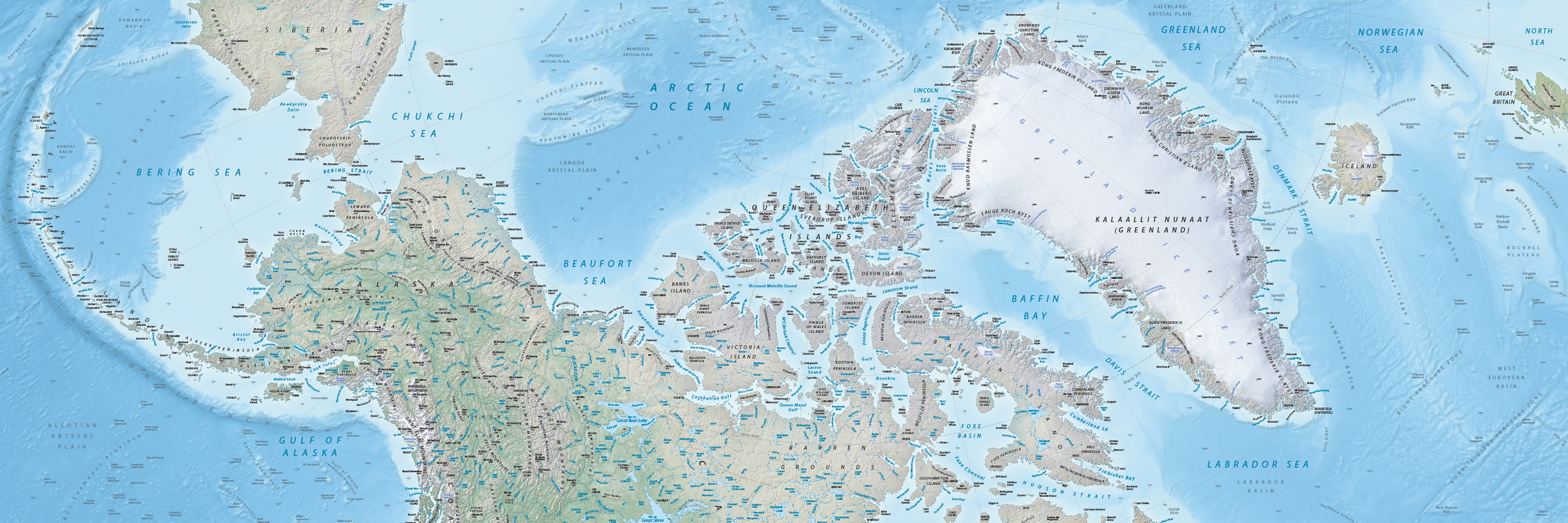
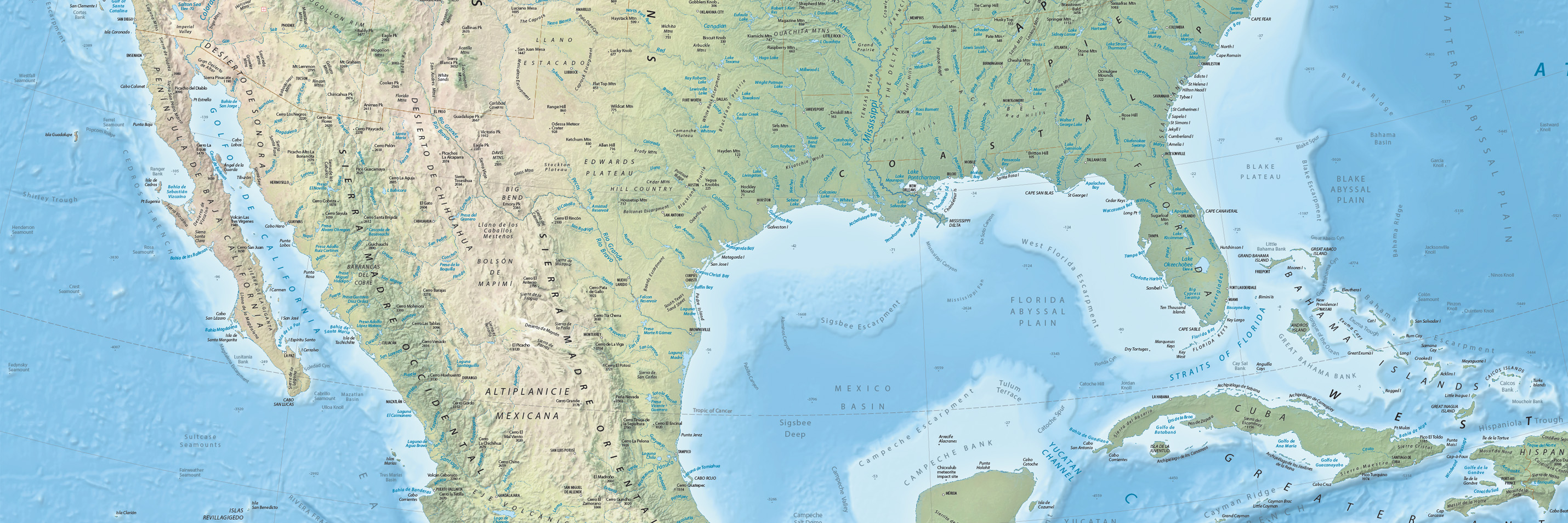
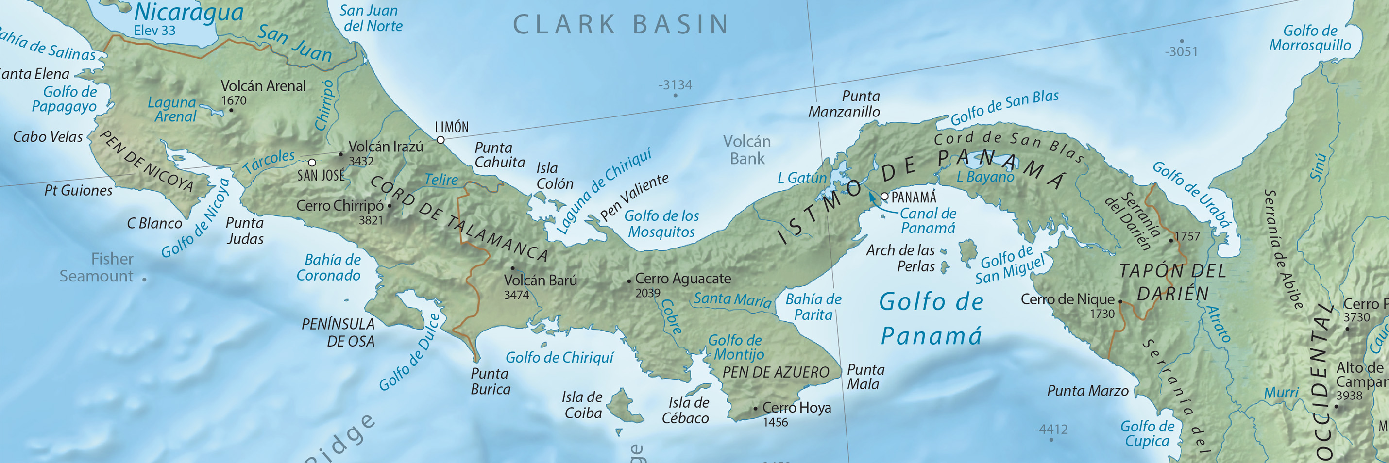
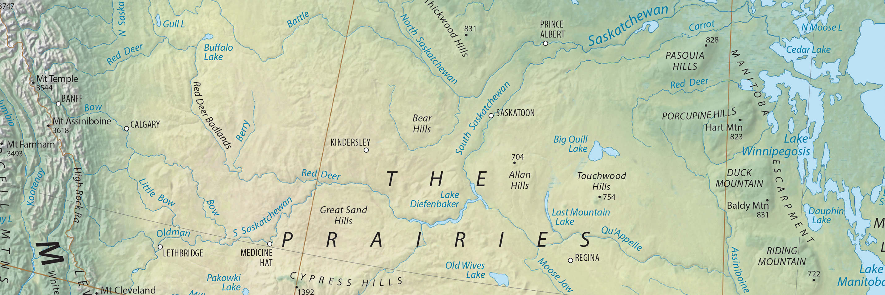
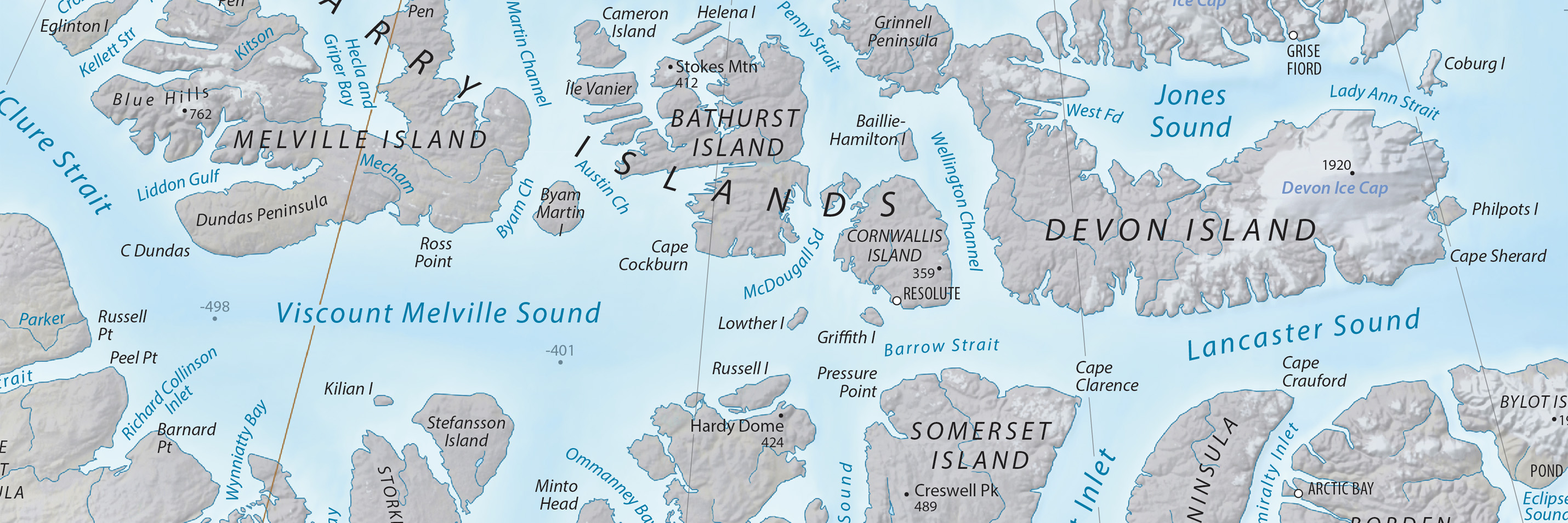
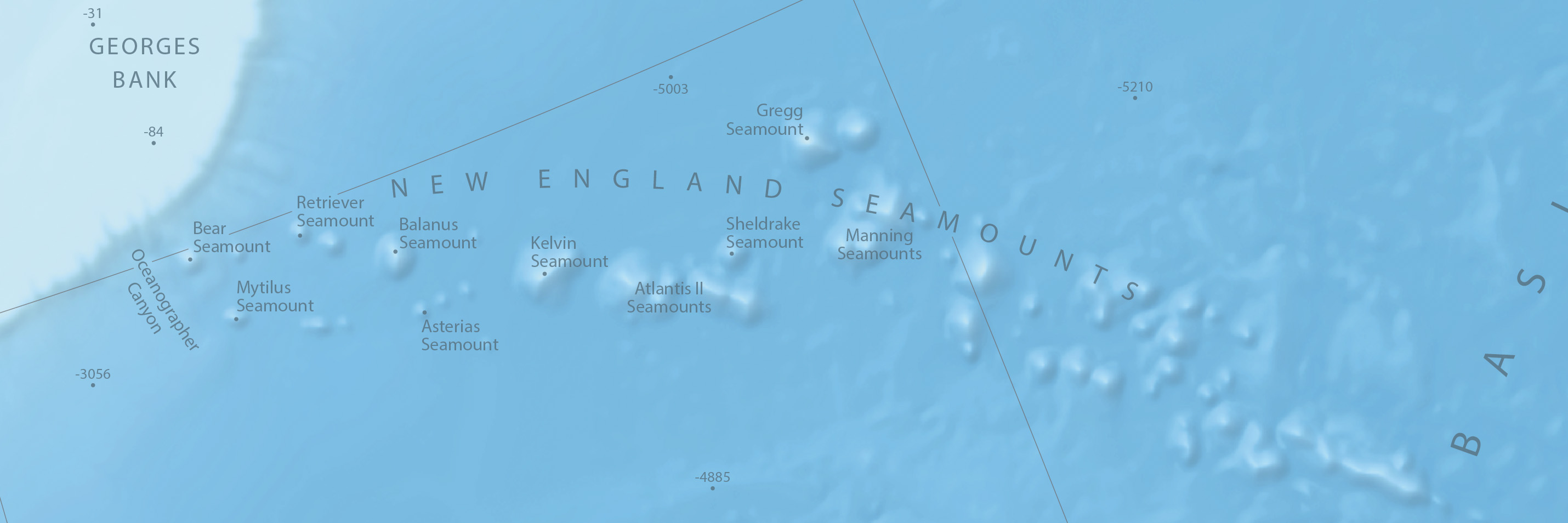
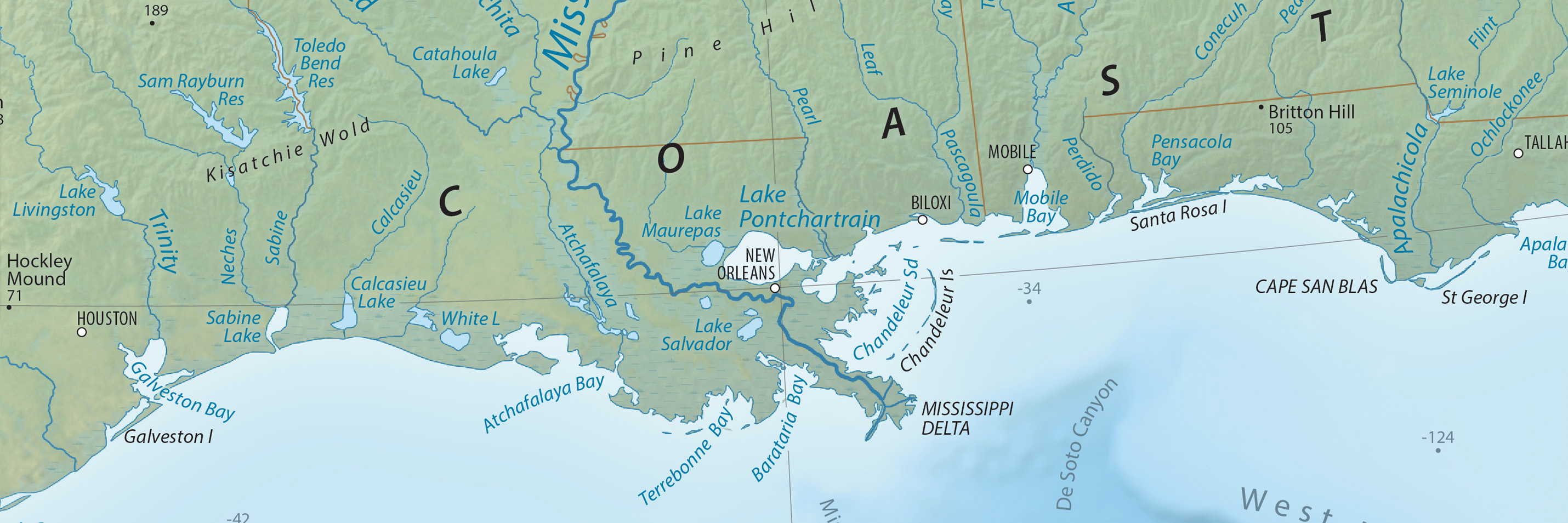
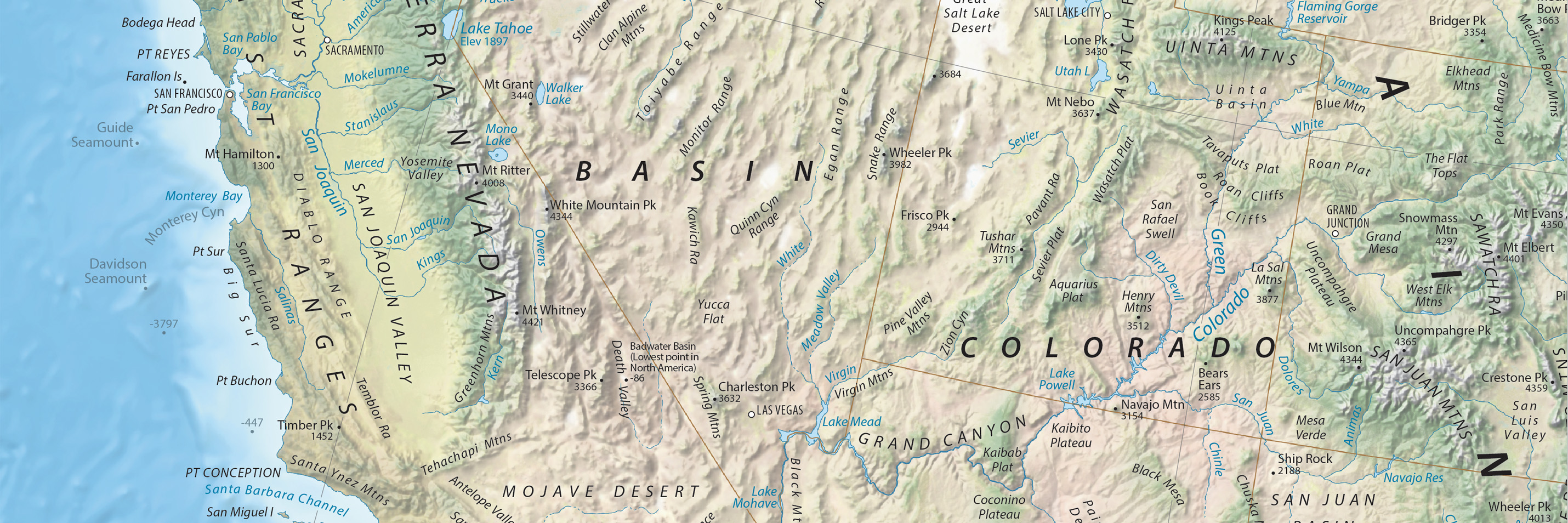
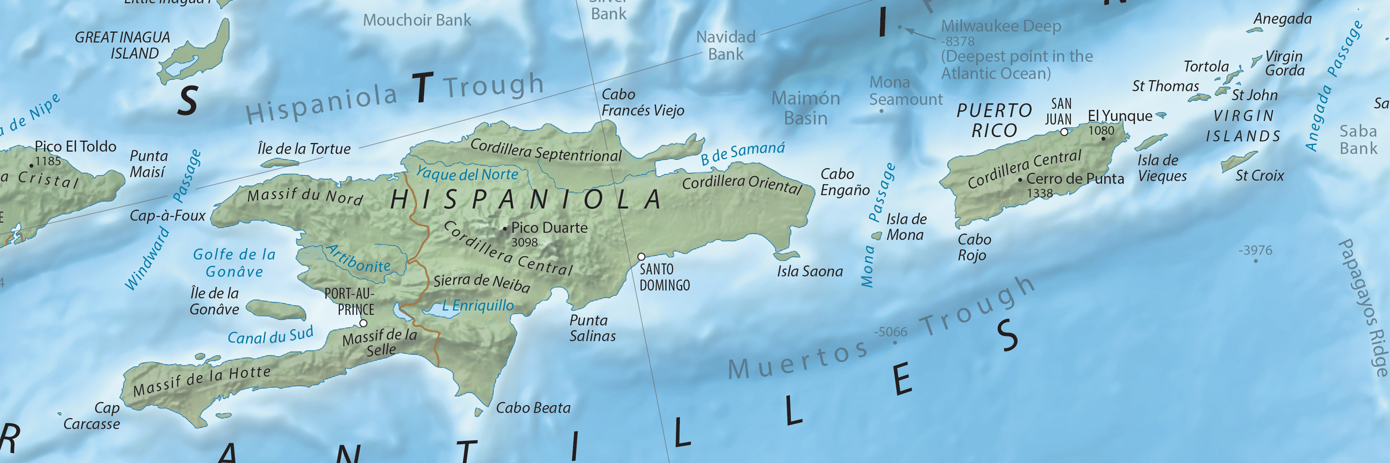
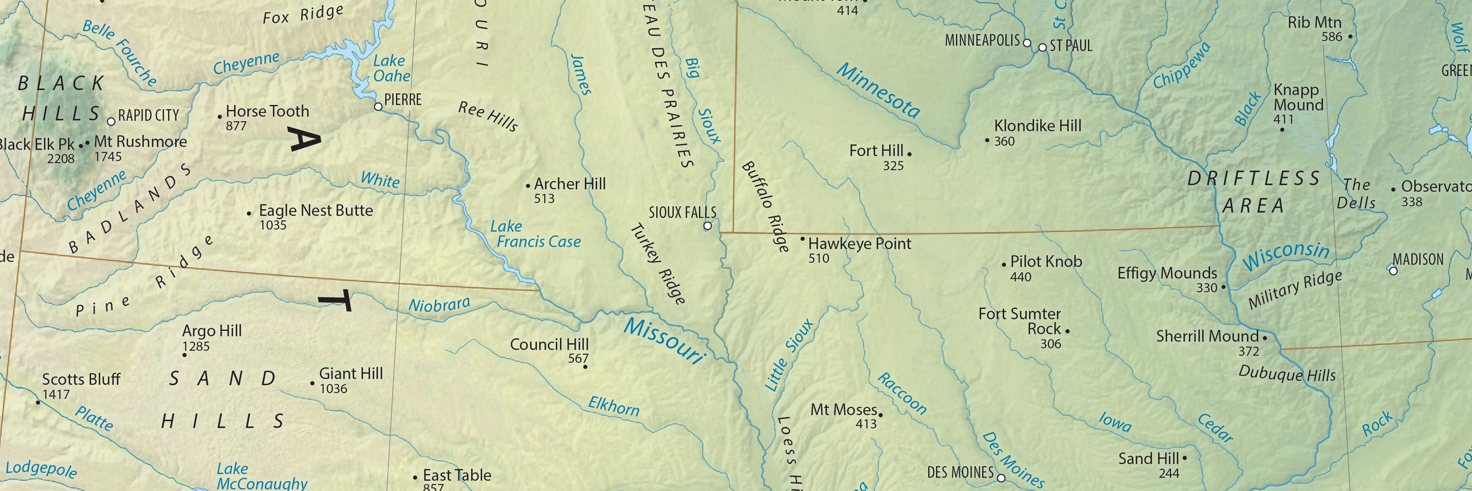
North America is an ideal continent for physical mapping. The irregular coast, varied terrain, and diverse environments form a cartographic mosaic of colors and textures. Besides being beautiful, these features also tell geographic stories. The cordillera running along the entire Pacific coast gives evidence of the theory of plate tectonics. And looking south from Canada’s arctic islands to Panama’s rain forests, we see the influence of latitude and elevation on natural vegetation.
I made this map during the winter of 2020-21 to keep busy during the pandemic. It is comprised of freely available geospatial data that I manipulated using GIS and graphical software. To decide which features to label, I consulted maps, atlases, and numerous online sites, including Peakbagger, PeakVisor, and Wikipedia. I am very grateful to the many people on Twitter who commented on a draft of the map.
I hope that you enjoy using the map as much as I did making it.
Tom Patterson
January 6, 2024
Map downloads - Pick the version best for you
Physical Map of North America
Terms of use
The Physical Features of North America map is in the public domain. You may use it any way that you want. You are not required to cite the map.
5,000+ labels!
Terrain art without type and type halos
Georeferenced terrain with hydrography, GeoTIFF, 350 DPI, 234 MB
Contact me
I will periodically update the map. Please let me know about major features to include or any problems that you find.
Thanks!
Tom Patterson Bio
Version 1.04, January 6, 2024 Change Log