
Take a deep dive
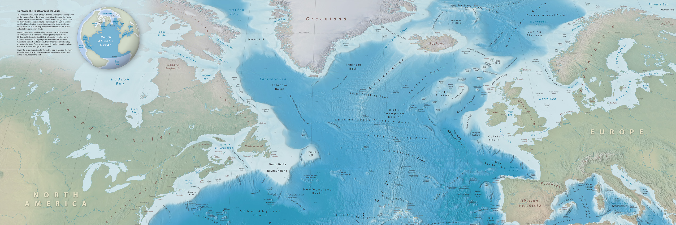
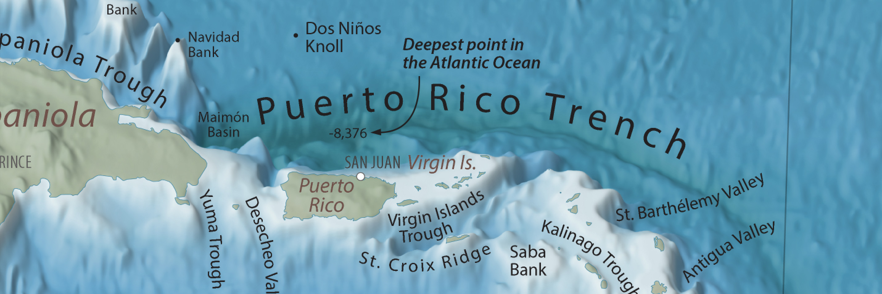
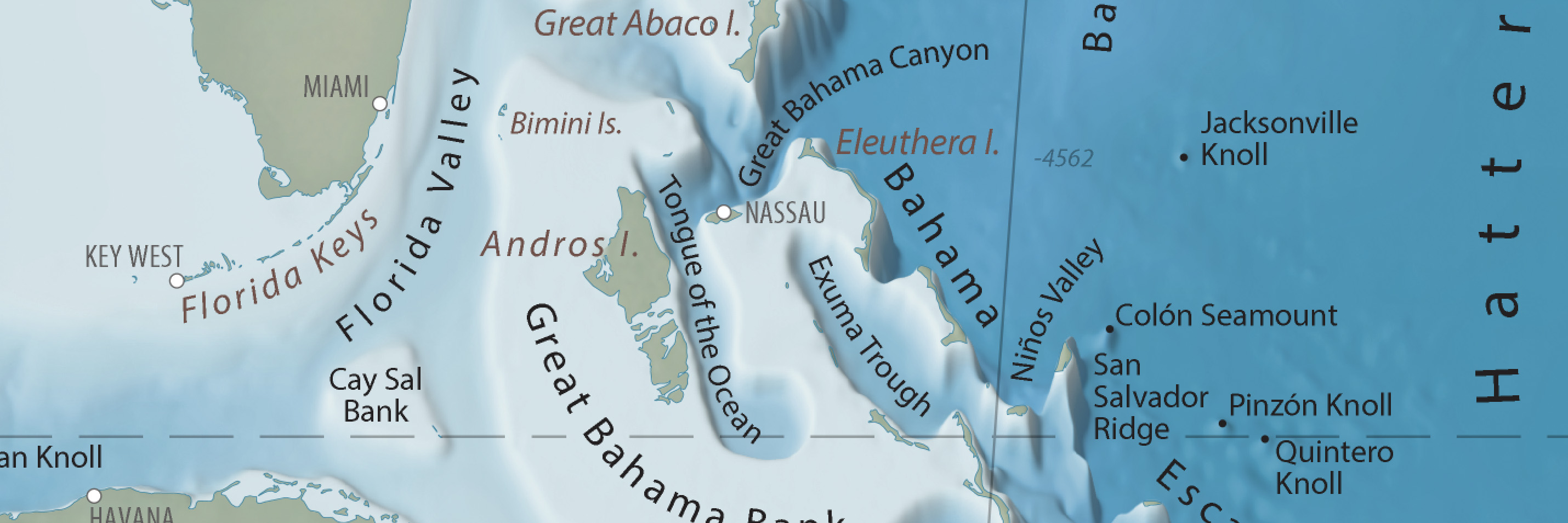
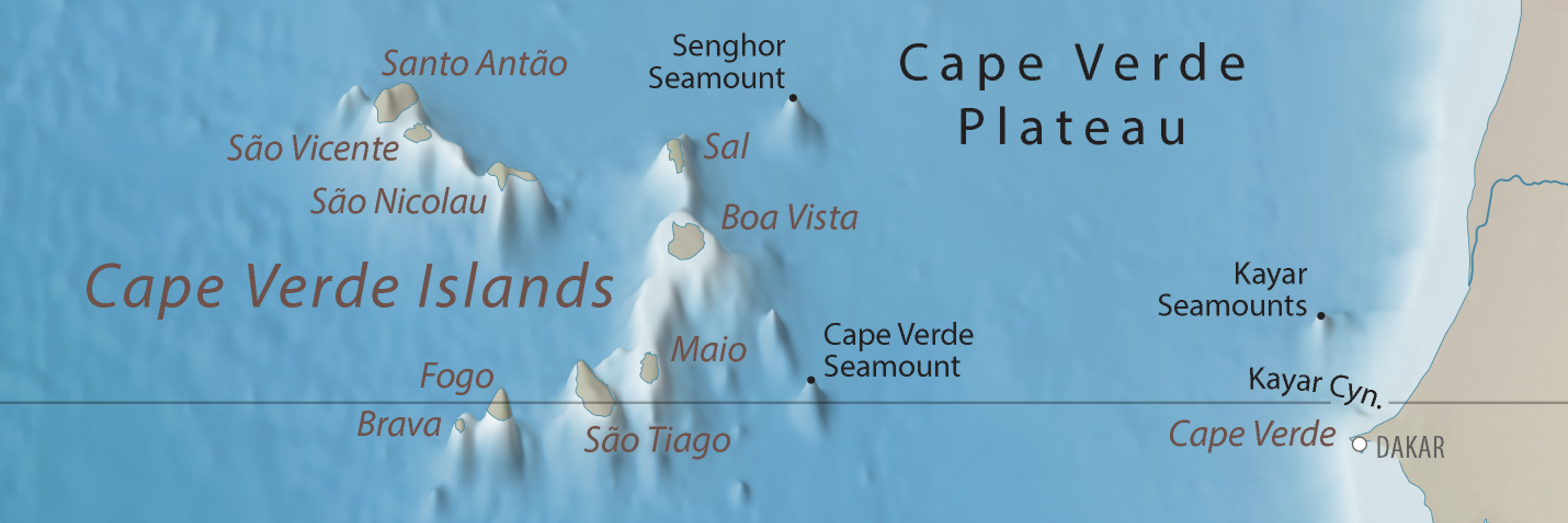
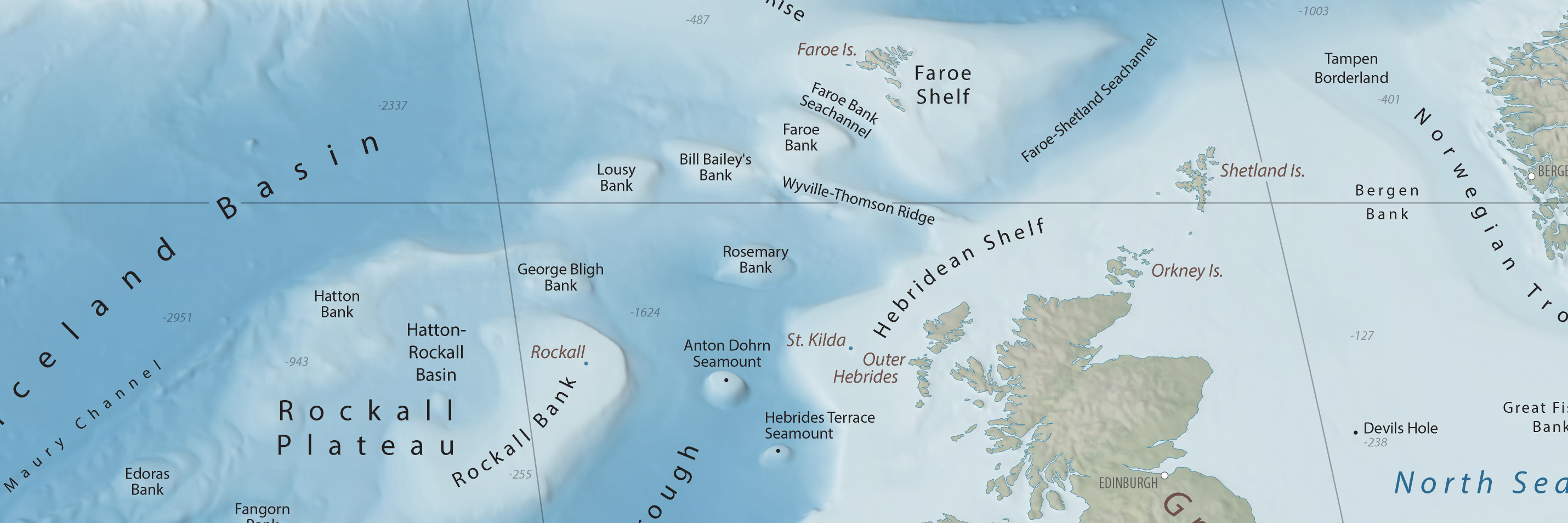
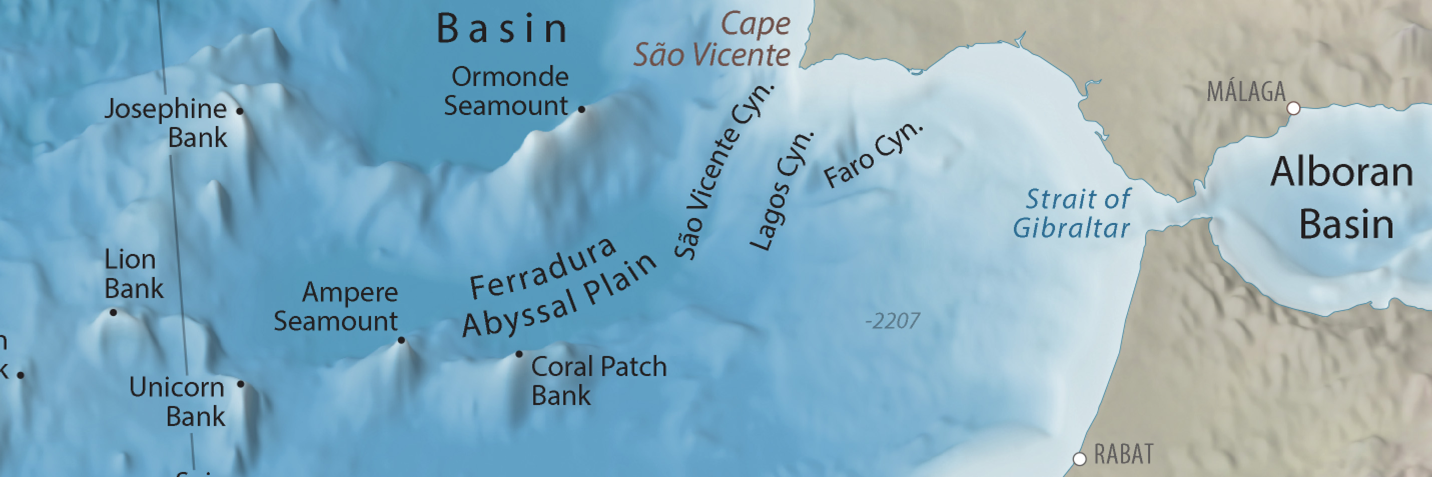
This map showcases the exotic bottom features of the North Atlantic Ocean, including abyssal plains, banks, canyons, seamounts, trenches, and the scar-like Mid-Atlantic Ridge. Above the waves, the map offers select coastal cities for reference.
Blue Earth Bathymetry is the source of all topography shown on the map. It is an edited version of the GEBCO (General Bathymetric Chart of the Oceans) dataset. The 3D topography, rendered as plan oblique relief, depicts undersea features in partial profile with 1,100 percent vertical exaggeration.
Mapped terrestrial areas derive from Natural Earth vector and raster data. The GEBCO Gazetteer of Undersea Feature Names was the source for ocean bottom labels.
The map is in the public domain and available free of charge. I hope that you will find it informative.
Tom Patterson
July 29, 2020
Downloads
North Atlantic Seafloor Map
Map with type
RGB JPEG image, 40.5 x 30", 350 DPI, 21.5 MB
Map without type
RGB JPEG image, 40.5 x 30", 350 DPI, 16.7 MB
Editable map with terrain art
Terms of use
The North Atlantic Seafloor map is in the public domain. You may use it any way that you want.
Contact me
I will periodically update the map. Please let me know about major features to include or any problems that you find.
Thanks!
Tom Patterson Bio
P.S. Also check out the Seafloor Map of Hawaii here.
With 3D topography!
Version 1.0, July 29, 2020