Making 3D Terrain Maps |
||||||||||||
--Flooded Land |
||||||||||||
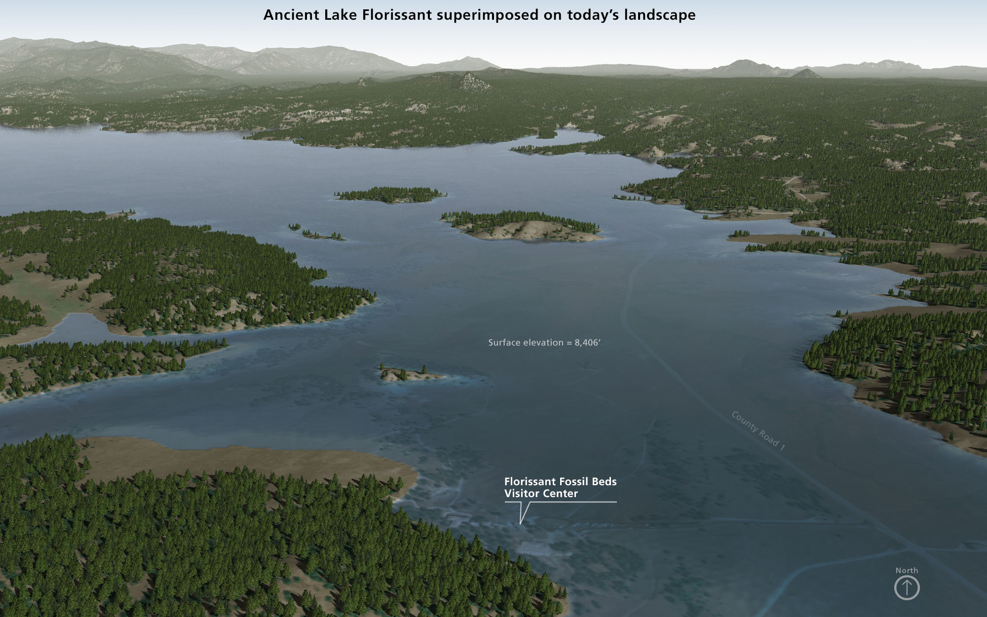
We tend to think of water bodies as immutable through a personal lens of how they appear in the present. But over the course of time, in the remote past and undoubtedly into the future, they will change in size, shape, and elevation. On this page we will look at a technique in Natural Scene Designer Pro for raising the height of lakes and oceans. The scene below of Florissant Fossil Beds is an example. To create the ancient lake, I started with a present-day scene. The underlying 10-meter digital elevation model is draped with an aerial photograph and, on top of this, I planted background trees. In Natural Scene Designer Pro, a tree map tree governs their placement according to the aerial photograph (Settings/Trees/Load Tree Map). Next, outside the scene in the upper left, I used the "Edit Terrain" tool to draw a dam across the valley in the Map Window. I then used the "Create a Lake" tool to fill the dry valley with water at the precise surface elevation that I needed. I made the lake surface transparent to reveal details on the aerial photograph below the surface. Natural Scene Designer Pro automatically removed trees from the lake that I had created. |
||||||||||||
 |
||||||||||||
Ancient Lake Florissant, Florissant Fossil Beds National Monument, Colorado, as it may have looked 34 million years ago. (Click map to enlarge.) |
||||||||||||
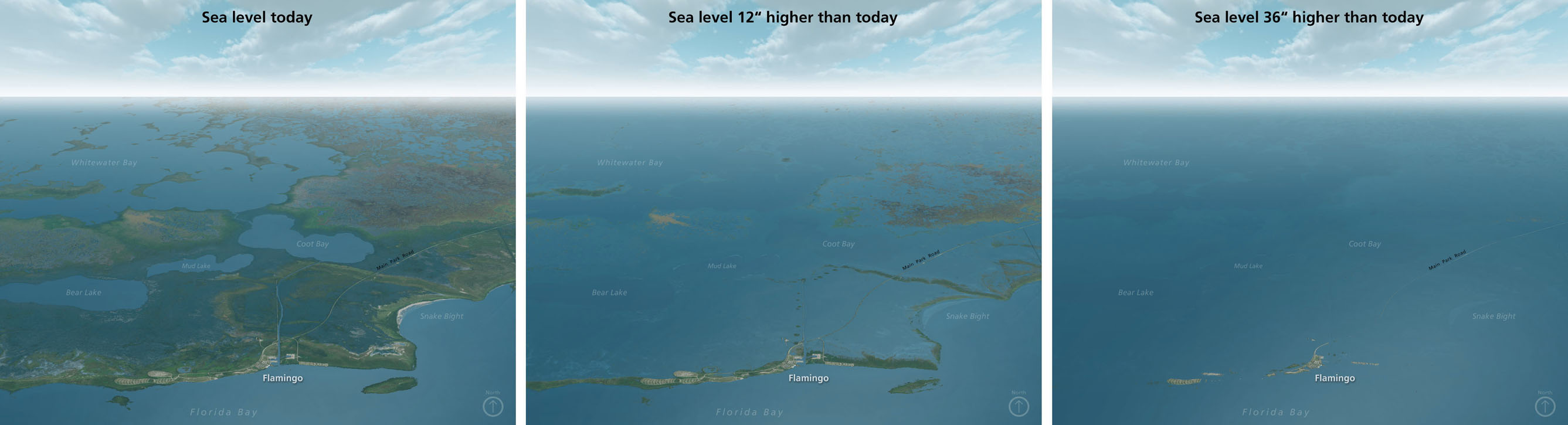
Raising the ocean level works similarly to that of lakes but without having to dam valleys. Go to Settings/Water/Ocean Level to specify the ocean level you want. The illustration below of Everglades National Park depicts the vulnerability of that low-lying region to flooding if sea level should rise for whatever reason. Clicking on the image will show you the predicted flooding that will occur if sea level should rise 12 inches and 36 inches higher than today. |
||||||||||||
 |
||||||||||||
Everglades National Park, Florida. (Click map to enlarge.) |
||||||||||||
Comment Raising the ocean level will show flooded land based solely on elevation. What it will not show are new coastline configurations based on ongoing geomorphologic processes. In general, inundated coasts become smoother over time. Promontories erode, bars form across bays, barrier islands emerge, etc. |
||||||||||||
 |
||||||||||||