Multiple DEMs
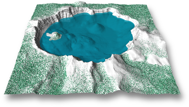
Crater Lake was constructed from a USGS DEM mapped with artificial textures to suggest the Cascade Range in winter. The simple outward appearance of the Crater Lake scene belies complex construction techniques that were used beneath the surface. Crater Lake was constructed from four separate pieces: three DEMs and a water surface. The DEMs are modified copies of the original USGS DEM positioned precisely on top of one another.
Construction started with a white DEM that represents the snow-covered landscape. It is masked to exclude areas below the lakeís surface. Stratigraphy on the crater rim was created in Bryce from a bump map texture constrained to steep slopes. Next, trees were made from a green DEM that was positioned slightly below the snow DEM. Noise was applied to the tree DEM in Photoshop, creating a grainy surface, and then imported into Bryce. Additional vertical exaggeration extruded the grainy texture through the snow surface until green tree nubs appeared. Finally, the lake bottom was created from a flat gray DEM that was masked for all areas except the bottom of the lake.
The water surface was created from a blue square cropped by a circle
slightly larger than the lakeís shoreline. Its edges are hidden within
the crater rim. The water surface was positioned (on the vertical
axis) at the water line in precise registration with the three DEMs. Reflections
of mountains on the lakeís surface are similar to what visitors see from
the rim. Digitally enhanced transparency permits the bottom to be seen
despite the great depths.
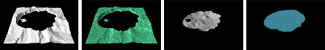
Crater Lake components: (from left) Snow, trees, lake bottom, and
the water surface.
Light source
The optimal light source varies with each 3D landscape, although light originating from the left or front left works acceptably with many scenes. Front left lighting was used for illuminating the final Crater Lake scene.
Back left illumination, the 2D cartographic convention, often places
deep shadows on slopes facing the viewer, obscuring foreground detail.
The same problem applies to light originating from the back and back right.
The opposite problem affects scenes illuminated from the front and top,
where highlights and shadows can be inadequate for landscape definition.
Right and front right lighting works well with scenes viewed from low elevations.
However, front right illumination can cause relief inversion when scenes
are viewed from higher map-like elevations.
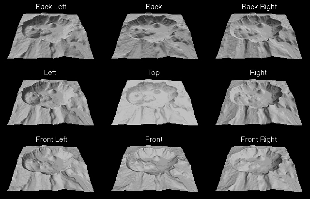
Variable illumination: The light source is 22.5 degrees above the horizon, except for the center image, which is at 90 degrees. Viewing is from 30 degrees above the horizon.